La Morra

Edited by:
Massimo Martini
Access
La Morra can be reached via the [A6] Turin–Savona motorway, taking the Marene-Cherasco exit; from the exit, head towards Cherasco and then follow the provincial road towards the town. From the north-east, you can take the Turin–Piacenza motorway to the Asti Est exit, continuing towards Alba and from there towards La Morra via the provincial road network. The nearest railway stations are Alba and Bra, both served by Trenitalia (TI); from both towns, you will need to continue by road. The nearest airport is Turin-Caselle. Local public transport is provided by inter-urban bus services operated by the Province of Cuneo, with a stop in the provincial capital.
Introduction
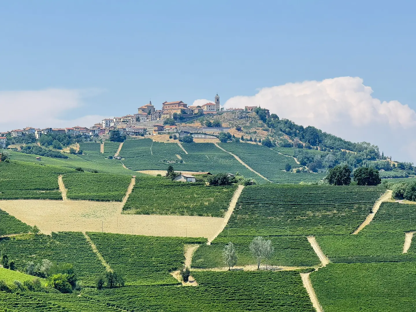
La Morra is a municipality in the province of Cuneo, situated on the crest of a ridge in the Langa hills, about ten kilometres south of Alba. The area extends across a system of ridges reaching an altitude of 540 metres, with slopes entirely shaped by centuries of vine cultivation. The municipality borders the other towns in the Barolo wine-growing area, including Barolo, Castiglione Falletto and Verduno, and its agricultural landscape forms part of the UNESCO site ‘The Vineyard Landscapes of Langhe-Roero and Monferrato’, recognised in 2014. The earliest documentary records date back to the High Middle Ages, when the settlement was moved to the top of the hill and surrounded by defensive walls; from 1340 onwards, the territory came under the control of the Falletti family, who shaped its history until its acquisition by the House of Savoy in 1631. The local economy is predominantly focused on the production of quality wine, with Nebbiolo grapes, used for Barolo, being the dominant crop.
Description
The municipal area is spread across a system of hill ridges, with slopes covered in rows of vines arranged to follow the natural contours of the land. The vineyards are situated at altitudes ranging from 186 metres at the valley floor to 540 metres at the highest points, within an agricultural landscape that forms part of the UNESCO site of the Langhe-Roero and Monferrato Wine-growing Landscapes. The etymology of the place name is a matter of debate: some sources trace it back to locus murrae, a Benedictine term denoting an enclosure for livestock, in reference to the monastic community established at theAnnunziata; other hypotheses suggest mora, the fruit of the bramble (Rubus spp.), or mola, a millstone once quarried in the Croera area. The Benedictine monastery of the Annunziata, founded in the 12th century and later taken over by the Servants of Mary, is one of the oldest religious settlements in the area; the architectural remains of the building now house the Ratti Museum of Alba Wines.
The settlement was moved to the summit of the hill between the 12th and 13th centuries and enclosed by a wall with two gates and several towers; this was demolished during the 19th century as the need for defence ceased. The bell tower, built in 1544 and remodelled several times, survives from the original structure; the historic centre also retains traces of the defensive system in its place names, with Piazza Castello occupying the highest point of the town and offering a sweeping view of the surrounding hilly landscape. Under the rule of the Falletti family from 1340, the territory followed the fortunes of this family until it came under Savoyard rule in 1631.
The economy is based on high-quality viticulture: alongside Nebbiolo – a grape variety already mentioned in the municipal statutes of 1402 under the name Nebiolium and used for the production of Barolo – Dolcetto, Barbera, Freisa, Favorita and Nascetta are also grown. On slopes less suited to viticulture, the cultivation of hazelnuts (Corylus avellana) – specifically the ‘tonda e gentile trilobata’ variety, marketed under the ‘Nocciola Piemonte IGP’ label – has become widespread in recent decades.
The municipality is ideal for food and wine-themed and scenic walks. The Sentiero del Barolo trail crosses the municipal territory, passing by the main historical landmarks and the area’s most representative vineyards. On the last Sunday in August, the Mangialonga takes place – a non-competitive food and wine walk that winds through the historic centre and the surrounding hills.
Information
General information
Area: 24.17 km²
Altitude of the main town: 508 m
Highest point: 540 m – [to be completed]
Population: 2,626 (as at 1 January 2026, provisional ISTAT figure)
Name of inhabitants: lamorresi
Patron saint: Saint Martin
Neighbouring municipalities: Verduno – Barolo – Castiglione Falletto – Roddi – Cherasco – Serralunga d’Alba – Narzole – Bra – Alba
Province: Cuneo
Region: Piedmont
Country: Italy
Official website: https://www.comune.lamorra.cn.it